Data lab · Status: In development
Access to public services
A public-data study of walking access from populated neighbourhood cells to registered primary-school locations in Dordrecht.
Purpose
This project examines how long it takes people to walk to public services. The first pilot uses registered primary-school locations in Dordrecht. Later versions may cover other types of service and changes such as a location opening, closing or moving.
Dordrecht pilot
The analysis starts with 1,666 populated grid cells from Statistics Netherlands. Each cell is 100 metres square. The model follows the shortest available route through the OpenStreetMap walking network at 4.8 kilometres per hour.
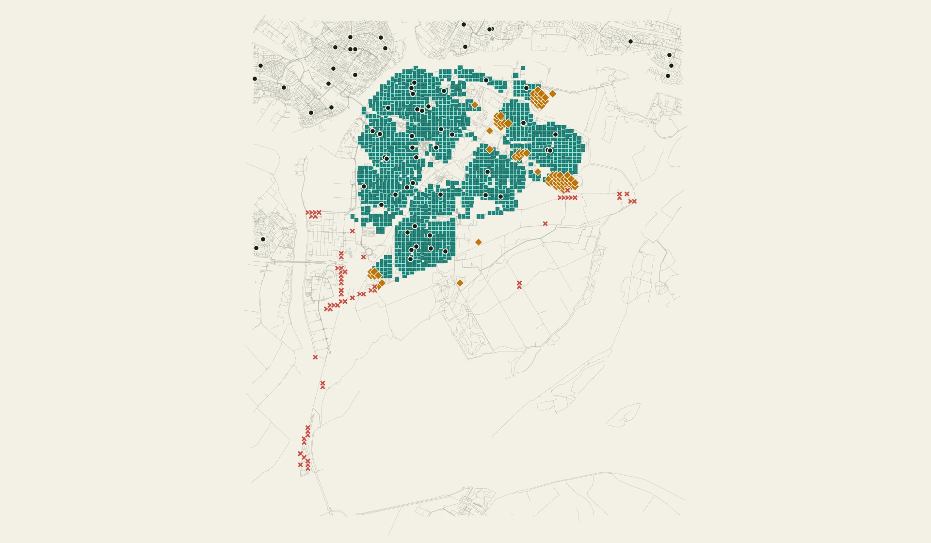
- Two or more BAG building components
- One BAG building component
- No BAG building component
- Registered destination
| BAG building components within twenty minutes | Populated cells |
|---|---|
| Two or more separate components | 1,540 |
| One component | 66 |
| No component | 60 |
The location registers leave two cases open to interpretation. I repeated the calculation with three defensible treatments of those cases. All three produced the same twenty-minute result shown above. Results at ten minutes were more sensitive, so I do not present that shorter threshold as a settled finding.
Method
The pilot combines four public sources:
- Statistics Netherlands geographical data and grid statistics
- DUO open education data from RIO
- The Dutch buildings and addresses register
- OpenStreetMap data and licence
RIO supplies the dated education registrations. BAG identifies the physical address and its related building components. Administrative records attached to the same BAG building component are therefore not counted as separate alternatives. Each populated grid cell and eligible destination is connected to the walking network before the shortest route is calculated.
Limitations
This is a geographical baseline based on public registers, not a live service directory. It does not establish opening hours, capacity, admissions, quality, safety or operational availability. A grid cell is also an approximation of where residents begin their journey. The locations have been reconciled against the registers, but they have not all been checked through field visits.
The exact source snapshots, versions and calculation record are retained in the separate project workspace. They are not published on this website.